IBL User Group Meeting will take place on 07th – 10th October 2019 in Innsbruck, Austria. Like last year, we plan to have four days of meeting, during which we will present recent developments as well as planned new functionalities in the Visual Weather, Aero Weather, Online Weather, Numeric Weather and Moving Weather products. A […]
Author Archives
peter.benovic
Meteorological Technology World Expo 2019
Upper level cyclones merging process
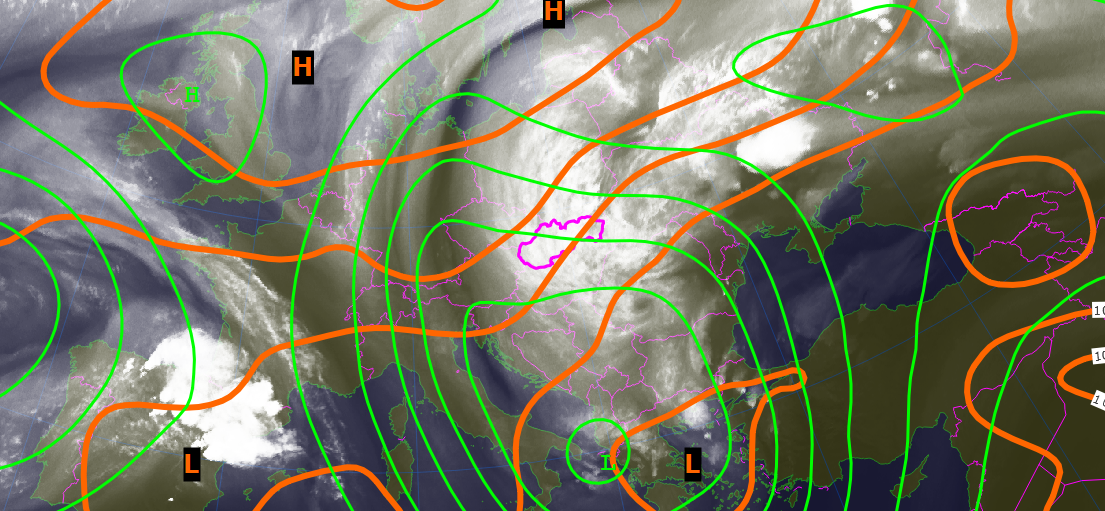
It is quite typical for summer circulation over central Europe that there is fading of baroclinic westerly current of weather systems from the Atlantic ocean. Instead of it we experience isolated upper level cyclones. The animation below shows merging process of these features resulting into one large vortex with approximately 3000 km in diameter. One […]
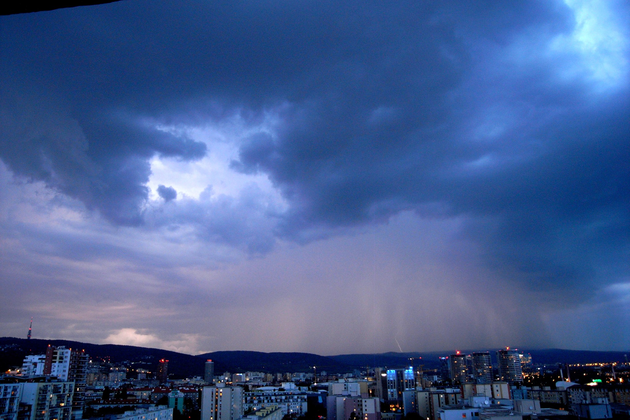
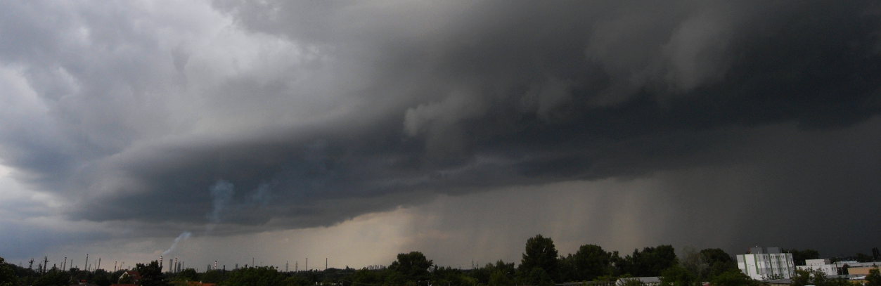
Cold Front Passage over Bratislava
After a long period of hot weather in Bratislava we finally experienced cold outbreak when temperature dropped from 32 deg to less than 20 deg. The radar image loop shows how isolated storm cells formed into large mesoscale convective system. The timelapse movie below shows overall situation as has been seen by eyes from Bratislava […]
Early spring supercell storm in Slovakia
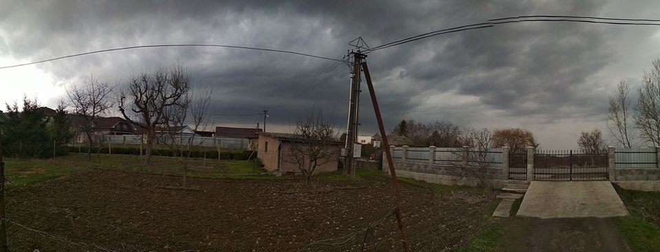
There was highly dynamical circulation development over the Central Europe during Eastern weekend with deepening cyclone movement from Mediterranean area across Alps toward Poland and the Baltic Sea. Several thunderstorms occurred over Slovakia in the afternoon on March 31st. One of them was captured nearby Kralovsky Chlmec in the Zemplin district area (southeastern part of […]
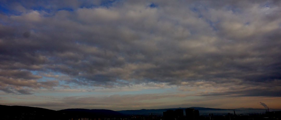
Stratocumulus clouds
Good Friday early morning in Bratislava. Wavy stratocumulus clouds dominate the scene with vertical wind shear. The first timelapse with a brand new camera Sony Alpha6000 🙂
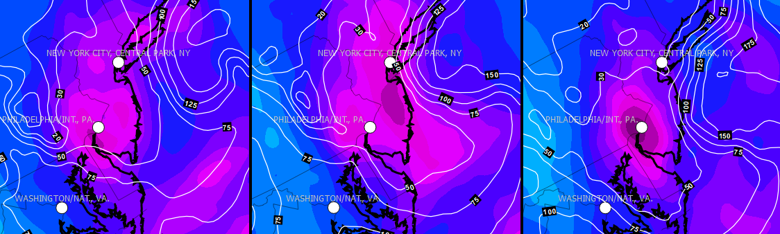
Another Nor’easter is heading for US East Coast
Meteorologists expect second winter storm in span of a week but they are not sure where it will hit…it seems from GFS model precipitation forecast consistency that the most affected areas will be around Philadelphia and New York City. These areas could be covered by 10-30 cm of wet snow during next night combined with […]
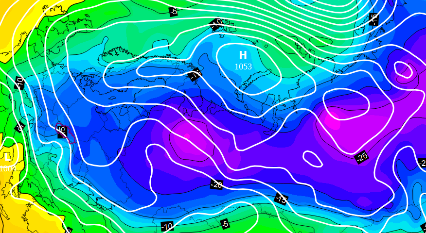
Massive cold outbreak is heading to Europe
This winter season was the 20th warmest on record in Slovakia (until February 15th), however, every tail has a sting. The European land is cooled down after all and mild maritime air is streamed deeply to the Arctic regions at the same time. As a response, strong anticyclone circulation over Scandinavia and Barents Sea is […]
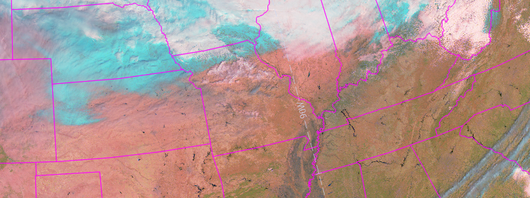
GOES-R new images
First images from the brand new GOES-16 are here! Combined into so-called “Near natural” RGB composite, it can distinguish ice from water clouds during daily hours, thus we can take a look at the North America continent snow coverage (light turquoise colours without movement). The animation below shows how quickly is snow vanishing over Kansas and […]
Summer remind
Now, in the middle of winter, it is the right time to recall summer sky with huge cumulonimbus clouds and thunderstorms. The first timelapse animation shows scattered cumulus clouds with progressive vertical development. There were several thunderstorms in a row which is a quite rare phenomenon in Bratislava. The last one directly hit camera position […]