In today's data-driven world, weather information is essential for countless industries and applications. Whether you're building a weather app, optimizing weather dependent operations, accurate and reliable weather data is invaluable. Open Weather is your go-to solution for all your weather data processing needs.
With a vast array of data points, including current conditions, forecasts, historical data, and specialized information like air quality and marine forecasts, Open Weather provides the comprehensive weather intelligence you need:
Open Weather excels at handling the immense volume and complexity of weather data. It efficiently processes vast datasets from diverse sources like satellites and high-resolution models. The platform's robust infrastructure, including hybrid client technology and super cache, ensures seamless data management and rapid retrieval. This allows users to access and analyze large quantities of weather information quickly and effectively, supporting a wide range of applications from weather forecasting to climate research.
Open Weather leverages open standards to ensure seamless data exchange and accessibility. By adhering to protocols like OpenGIS Web Coverage Service (WCS) and the Environmental Data Retrieval (EDR) API, Open Weather provides a standardized framework for publishing and accessing diverse weather data. This promotes interoperability, allowing users to easily integrate weather information into their systems and applications, fostering innovation and collaboration within the meteorological community.
Open Weather harnesses the power of cloud computing on platforms like Amazon AWS, to achieve unparalleled scalability. By adopting a serverless architecture, Open Weather dynamically adjusts its resources to handle fluctuating data volumes and user demands. This cloud-based approach allows for rapid scaling to accommodate growing data sets and increasing user numbers. As a result, IBL Open Weather can deliver high performance and reliability while optimizing costs and maintaining flexibility.
Open Weather is a product for the cloud era, thus achieving scalability using technologies such as autoscaling groups and serverless lambda functions. At the same time, its design also allows for scaling down, enabling efficient operation in a more traditional on-premise environment.
But Open Weather's reach extends beyond a single cloud environment. It's cloud-agnostic, capable of functioning optimally within AWS, Azure, or even private data centres powered by OpenStack.
Open Weather’s architecture is specifically designed to process immense volumes of data and meanwhile capable of scaling up to meet the needs of millions of users.
Open Weather offers a range of editions to cater to the diverse needs of our customers. Each edition provides a specific set of features and data points, ensuring you get the right level of weather information for your application.

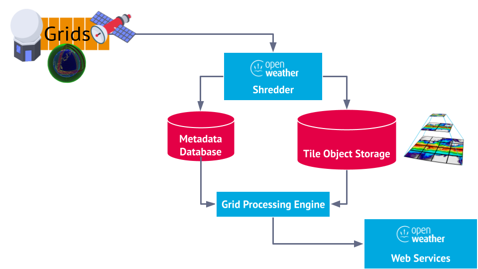
Grid Elastic Database (GED) serves not only as a repository for existing ingested grids, but it also has the capability to generate added value products. In parallel to the Field Diagnostics functionality provided by Visual Weather, GED enables the computation of derived grid fields. This functionality enhances the database's utility, allowing users to extract further insights and develop more sophisticated analyses from their grid data.
There are 2 modes of computing derived grid fields.
Grid Elastic Database offers advanced interrogation tools for ensemble models, placing the power of cutting-edge weather forecasting in the hands of skilled users. With these features, users can effectively analyze and modify ensemble datasets, paving the way for more accurate and insightful predictions. As ensemble models continue to shape the future of weather forecasting, Open Weather equips users with the necessary tools to stay at the forefront of meteorological advancements.
Power users of Open Weather can take advantage of these advanced features, and reveal valuable details from ensemble models:

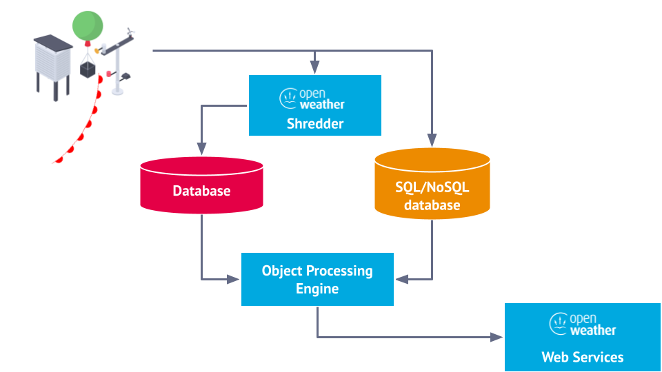
Point observations or polygon objects, such as weather warning areas, can efficiently stored in the Object Elastic Database (OED). This database is specially designed to handle large quantities of point-based or polygon- based weather data, allowing weather services to effectively manage and query location-specific information in space and in time.
Object Elastic Database supports natively a variety of input formats:
The Object Elastic Database (OED) features the Collection Processor, designed to seamlessly handle complex datasets by responding to notifications about their updates and creating new post-processed datasets. For example, from a source database containing near real-time lightning observations, the Collection Processor can create a dataset with 5-minute summaries, aggregating all lightning observations for that period. This aggregated data may be more useful for some downstream applications.
The Collection Processor operates as a periodically triggered service function, efficiently managing data processing in a stateful manner. With its ability to store a resume token for continuous data processing, this service function ensures uninterrupted operation even in dynamic environments. Configurable to run with a single instance, it optimises concurrency and guarantees consistent processing without redundancy.
Using same process Object Processor can monitor specific datasets for incoming real-time observations and derive a new dataset with alert objects, which are created when a source observation triggers warning or critical alerts. Developers can implement any kind of algorithm, including Machine Learning, to transform source objects into new objects. In reference to the previous example with lightning, incoming lightning observations can be collected and turned into polygonal objects depicting alert areas where lightning is active.
The primary output of Open Weather are Web Services and APIs. With Open Weather, your data will be available in a wide variety of standard outputs and protocols, including:
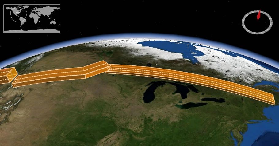
Through these, the Open Weather provides the ability to slice and dice data across varying geographic ranges, facilitating polygonal extractions and even complex 4D (space and time) trajectory extractions. One can also perform intelligent data resampling and vertical and temporal interpolations. This ensures that weather data isn't just comprehensive but is also finely tuned to user's precise needs and context.
