By reaching Category 3 intensity hurricane Ophelia has become the strongest hurricane ever observed so far in the east in the Atlantic Ocean. We could even observe the eye as close to the western European shore as never before. Above all, this hurricane underwent so-called transition to the common midlatitude cyclone. This process can be typically seen in higher latitudes and much closer to North America so we witnessed something really unusual.
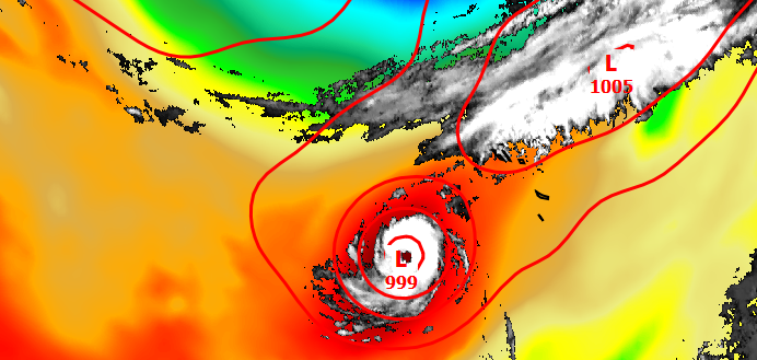
Animation of infrared satellite images, equivalent temperature and sea level pressure
The animation above shows the process – at first, strong hurricane with distinct eye over warm sea and out of any horizontal temperature gradient. Consequently, on October 13th, cold air from high latitudes was approaching to the hurricane circulation system and was rotating around it. This process provided additional energy to the weakening hurricane and low pressure area was revitalising – pressure was decreasing in the centre again. As we can see in the animation, clouds of both – Ophelia and mid-latitude cold front – became one weather system on October 14th. However, the resulting cyclone was moving much quicklier and it had a very different cloud structure. Instead of a small symmetric disc with a distinct eye in the middle we could observe system of fronts – very long but narrow belts of clouds spirally curved to the circulation centre with different temperatures on both sides. So-called Ex-Ophelia was a very powerful weather system. The sustained wind speed 31 m/s with gusts up to 43 m/s and sea waves 10 meters were observed on the Ireland’s shore. Watching the animation we can surely say this transition process is one of the most beautiful we have ever seen.
0 Comments Leave a comment
Comments are closed.