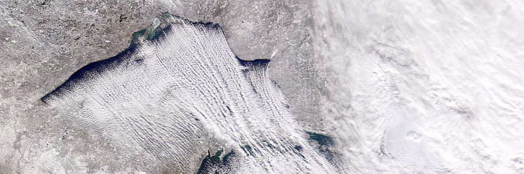
The most fabulous circulation setup of this winter in the Central Europe was the very cold air outbreak around January 6th. Temperature at 850 hPa level reached -20°C above Poprad aerological station, which is a very rare value within the last 25 years.As the cold air flows to the south over the Baltic Sea, temperature in 850 hPa level (1500 meters above sea) is almost -20°C, whereas sea surface temperature is up to +5°C. This forms super-adiabatic lapse rate of 25°C in only 1500 meters. It allows vigorous heat and moisture transportation vertically and thus convective clouds with intense snow showers are generated. This process is called lake-effect snow and is typical for the Great Lakes area in the U.S., northern Japan or Baltic Sea…
Animation 1 shows infrared satellite image (IR 10.8) combined with temperature field at 850 hPa. We can see quick onset of convective clouds over the Baltic sea. Clouds are organized to so called cloud streets which are typically parallel to the vertical wind shear vector. Note the “cloud shadow” south of the Gotland island which is a natural obstacle for winds thus moisturized air must flow around it.
This moisturized arctic air was transported far to the south by strong winds, down to the Slovakia. Animation 2 shows timelapse photography of typical weather we can expect in such environment in Bratislava – very unsettled one with constantly repeating snow showers. Clouds are very vague sometimes, it seems like there are only snowflakes falling down from the sky.
0 Comments Leave a comment
Comments are closed.