A Leading Weather
Software Solution Provider
Software Solution Provider

Aviation meteorologists have specific expectations from a forecasting workstation because their work is regulated by the ICAO Annex 3 and its amendments, ICAO SIGMET and AIRMET guides, regional legislation such as Regulation (EU) 2017/373, or guides published by the World Area Forecasting Centres (WAFCs). There are new technologies like the IWXXM or the SADIS API. Visual Weather strives to stay ahead of the changes so that you can always display the latest data formats and issue products that are compliant with the regulations.
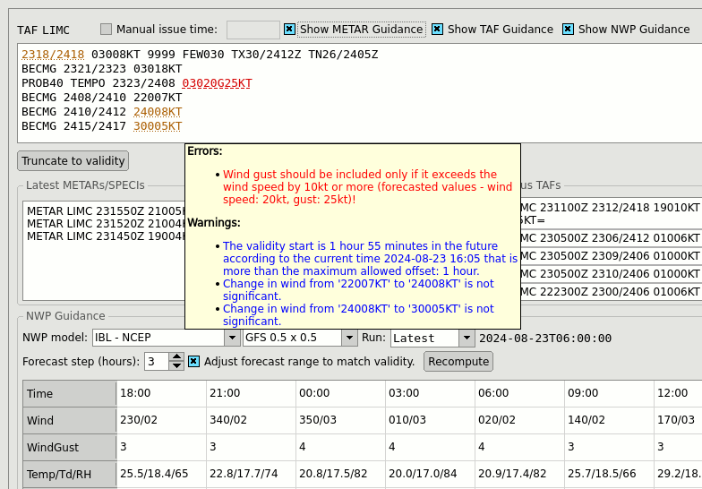
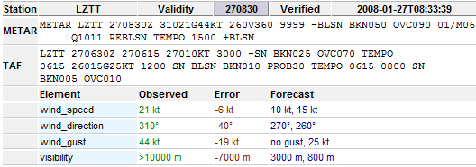
Create ICAO Annex 3 compliant TAFs supported by a robust validation suite — going from simple checks all the way down to evaluating the significance of TAF change groups to avoid verbosity that does not bring value to the pilots.
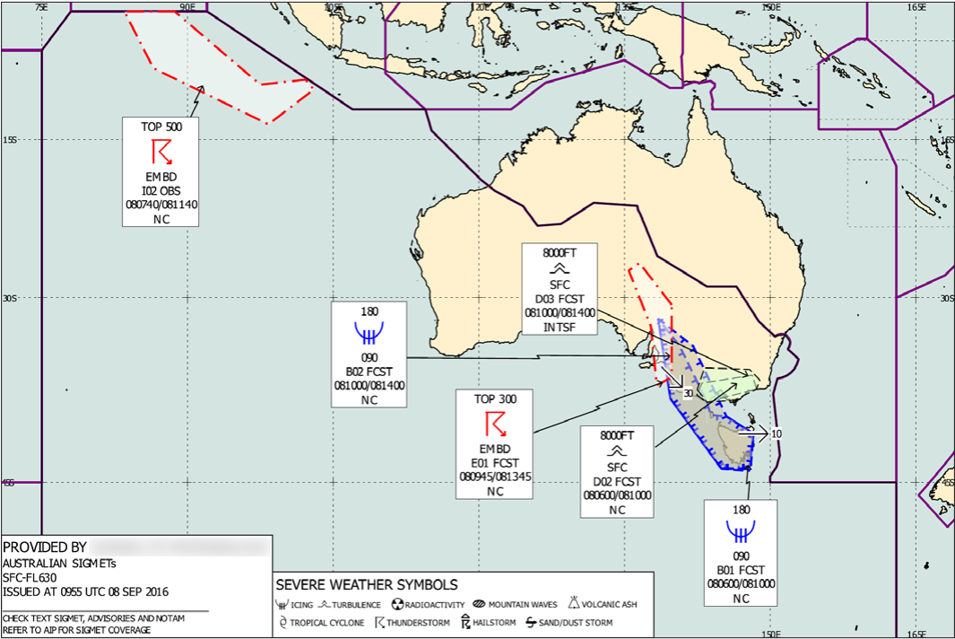
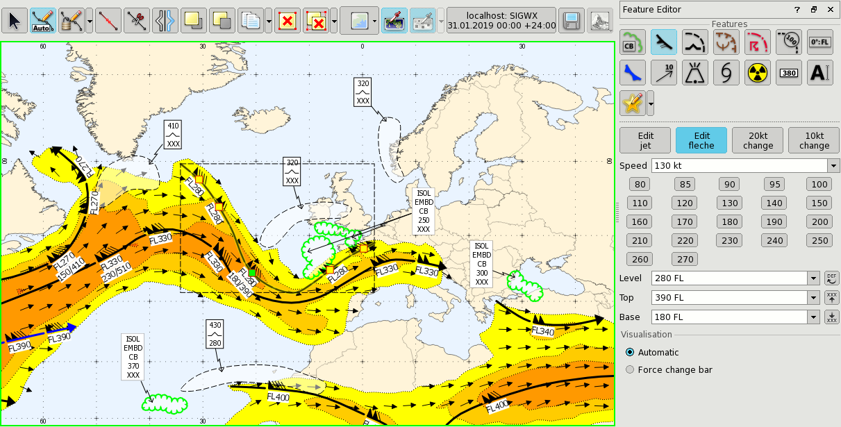
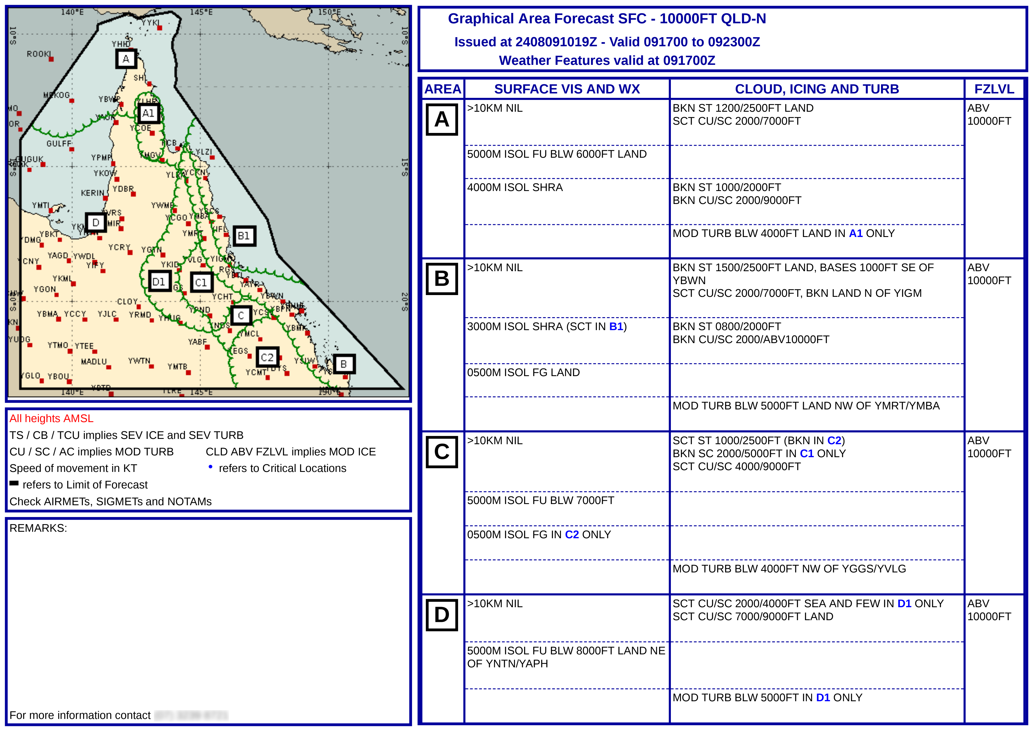
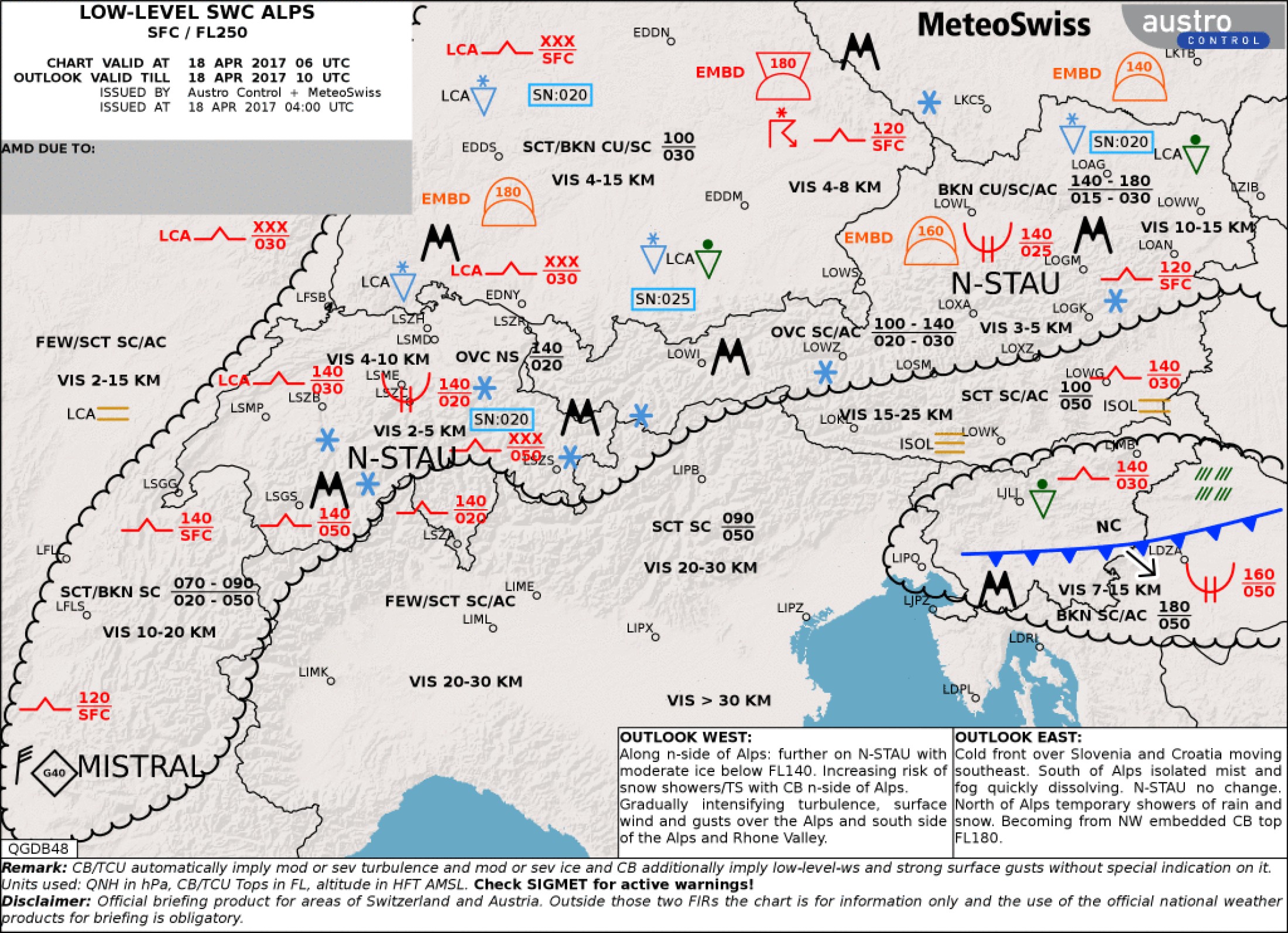
Draw thunderstorms, turbulences, mountain waves and all the other aviation hazards on a map and leave the correct formatting of the messages to the system.
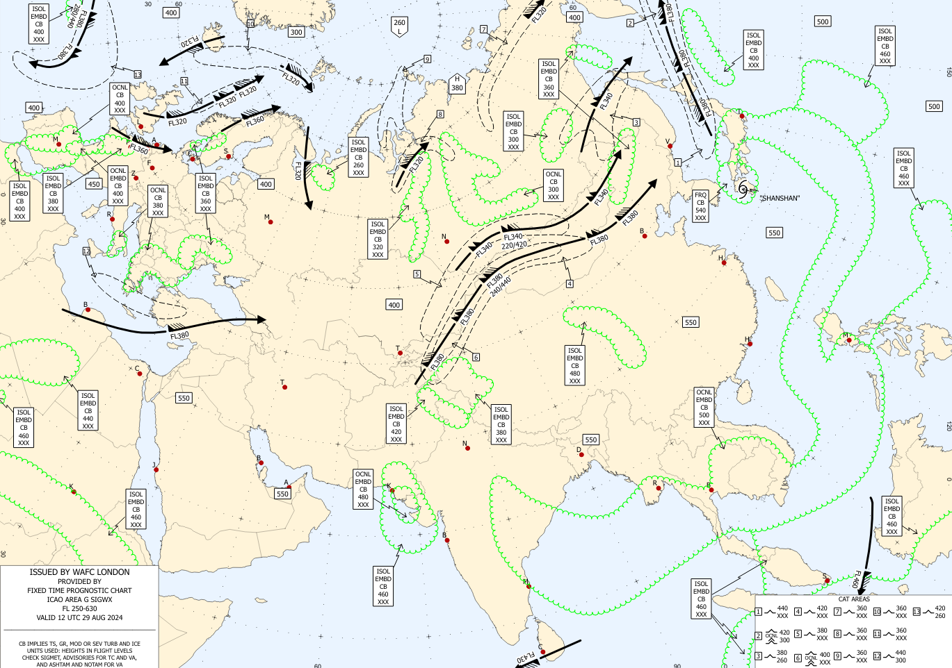
Easy to use drawing tool supports all types of common Significant Weather (SIGWX) charts: from the WAFC standard SWM and SWH to national low-level SIGWX that can be customised according to local needs. Draw clouds, jet streams, turbulence areas, etc. Any of your meteorological data can be used as a background during drawing, so no more looking at a different system and trying to match the right position.
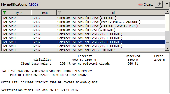
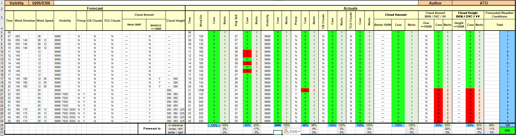
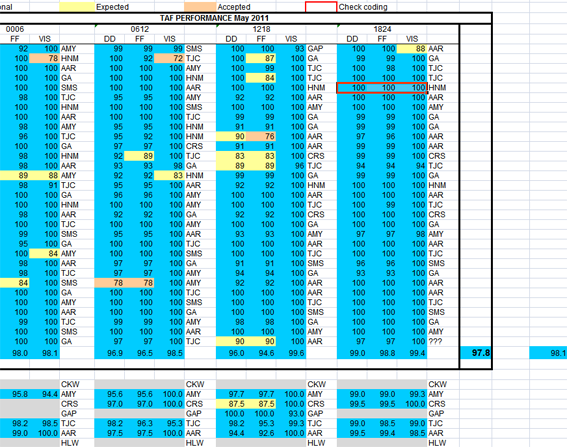
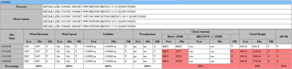
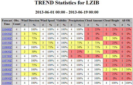
Keep your TAFs under review and receive alerts when the forecast diverges from the incoming observations. Evaluate TAF & TREND quality on long term (e.g. monthly) basis with automatically calculated scores. The evaluation criteria implement techniques defined by ICAO Annex 3, but custom rules can be implemented too.
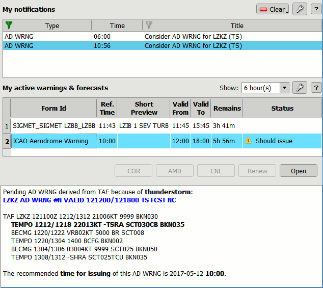
Re-use the expertise you put into creating the TAF and derive the aerodrome warnings text from your forecast: if the TAF contains dangerous weather, Visual Weather will automatically generate a suggestion for AD WRNG that can be loaded into and entry form with a single click and either issed as is or modified by the meteorologist.